The Route of the 8 Villages of the Vall de Gallinera

Route of the 8 Towns, Vall de Gallinera

The Route of the 8 Towns is a charming excursion that connects the 8 small and picturesque towns of the beautiful Vall de Gallinera , in the interior of the Marina Alta region of Alicante.

The Ruta dels 8 Pobles is a route that can be done at any time of the year , although it is especially recommended in March , coinciding with the flowering of the cherry trees that dye the slopes of the Vall de Gallinera white, in a natural spectacle of great beauty.

It is a linear excursion (round trip) of 14 kilometers in total length, although we can only do the section that interests us. The route is signposted and runs mainly along paved agricultural roads, with gentle slopes (with a few small exceptions), making it perfect to do with children.

Cherry trees in bloom, the Vall de Gallinera, route of the 8 villages
The cherry trees, protagonists of the route of the 8 Towns.

La Vall de Gallinera is a beautiful valley between mountains in the interior of the Marina Alta region, north of the province of Alicante. This beautiful corner of our geography is known, among other things, for the cherry trees that cover the slopes of its mountains, offering the spectacle of flowering during the month of March.

As it is a long route, I have divided the chronicle of this route into two parts . You can see the table of contents below:

The Route of the 8 Pobles, the Vall de Gallinera
Cherry Blossom Route Vall de Gallinera
Cherry trees in bloom in the Vall de Gallinera

Route Summary

Route of the 8 villages, the Vall de Gallinera
Information panel of the Ruta dels 8 Pobles

The Ruta dels 8 Pobles (Route of the 8 Towns) is a simple route that runs mostly along agricultural roads, connecting the 8 towns (one of them abandoned) of the beautiful Vall de Gallinera.

Data sheet

recommendations

Recommended time : March, for the flowering of the cherry trees. In that same month, and in October , you can enjoy the astronomical phenomenon of the Penya Foradà Solar Alignment .

Despite being a simple route, the total distance is 14 kilometers. Being a linear route (not circular), doing it completely round trip (28 km), is usually too much. That’s why I recommend two options :

  • Leave a car at the beginning and another at the end, in order to complete the 14 km in full.
  • Do only part of the route . In this case, we can start in any of the towns, although it may be more interesting to do it in the central towns, which are the ones with the most services, such as Benialí , where the La Vall Town Hall is located.
Cherry Blossom Routes in the province of Alicante

Video about the Route of the 8 Towns

Before starting with the description of the route, I would like to invite you to watch the following video, with aerial drone images, where you can get an idea of the wonderful environment that awaits you in the Vall de Gallinera

Introduction, the Vall de Gallinera

Ever since I met her, La Vall de Gallinera has made a deep impression on me. I fell deeply in love with this land. First I discovered the Serra Foradà , in full spring burst. Then I visited El Miserat , also falling in love with the beauty of the route. The Ruta dels 8 Pobles , which I am telling you about today, is my third visit so far this year. It sure won’t be the last.

It would be easy to be selfish. I could keep the Gallinera treasure “for myself”. But it wouldn’t be fair. I feel compelled to share it. So you can enjoy it as much as I do. So that together we can help protect it. Because this is a treasure that we must take care of among all.

Route 8 villages Vall de Gallinera

The Ruta dels 8 Pobles is a walk through the friendliest, most humane, most traditional Gallinera. A route of 16 kilometers along this elongated valley. Starting in Benirrama, passing through Benialí, Benissivà, Benitaia, La Carroja, Llombai and Alpatró, and ending in Benissili. 8 towns, and many stories to tell the traveler.

And here I have to quote Cavanilles (extracted from Juanjo Ortolà’s website ):

“The Valley of Gallinera is about a league from east to west between the terms of Adzuvia and Planes, and barely a quarter from north to south between those of Villalonga and Alcalá de la Jovada. Its soil is uneven and ravine, but so populated with small places, so well planted with trees and used, that its delightful view is now examined in parts, now it is observed from the heights.”

One of the greatest attractions of the journey is the countless fountains and sinks that we find along it. This has been the aspect on which I have focused my photographs.

From source to source. And it is that in this area of the Marina Alta the rains are (or used to be) abundant, in a very different way from what happens in the south of the province, in the arid lands of l’Alacantí.

Abundant rains that give rise to numerous springs, which flow fresh and transparent from the steep rocks of the Serra Foradà , on the south side of the valley, or from the winding ravines of the Serra de l’Almirall , which closes the valley towards the North.

The priority on this occasion (in fact, on all of them) was to walk, enjoy every step , every corner. I invite you to do the same, and enter this beautiful valley with respect, admiration, and tranquility, savoring every turn of the road.

Solar Alignment in Vall de Gallinera
Solar Alignment of Penya Forada, every year in March and October.

✔️ PART 1: from Benirrama to La Carroja

In the first part of the Route of the 8 Towns we will travel the 7.5 kilometers that separate the Font de la Mata de Benirrama , from the Font de Baix de La Carroja . We will therefore visit the towns of Benirrama, Benialí, Benissivà, Benitaia and La Carroja, 5 of the 8 that make up this municipality.

And just to be clear: 7.5 kilometers one way . Then we have to return along the same path, leave a car at the beginning and another at the end of the route or, my recommendation, spend the night in Gallinera .

Let’s start!

Description of the Route and Photographs

We begin with this first part of the Route of the 8 Towns in the town of Benirrama, the closest to the sea, and therefore the one with the mildest temperatures.

We can start in the same town, or a little earlier, at Font de la Mata , the official starting point of the route. By the way, “mata” is the common name for mastic in Valencian, hence the place name.

Thus, the Ruta dels 8 Pobles leads us from the Font de la Mata de Benirrama, to the fountain of the same name, on the outskirts of Benissili, the highest town in the valley.

Route of the 8 villages, the Vall de Gallinera
The Arab heritage is very palpable in Gallinera. We will find multiple signs of it, like this palm tree in Benirrama

We start the tour in Benirrama . We leave the town along a paved road, which will be the constant of this route, always between terraces of cherry trees . The day has dawned cloudy, perfect for walking and better enduring the rigors of the month of July. The small oases that we will find on our way allow this gentle route, almost a walk, to be done in summer.

The first fountain we find is the Font d’Alcúdia , close to the uninhabited area of the same name. Next to it, a small raft full of life receives its waters.

Route 8 villages, the Vall de Gallinera
The abundant fountains and laundries of Gallinera, also protagonists of the route.

Shortly after, a gentle descent leads us to the road, which we cross, before continuing on to the next town on the route: Benialí . A name that, like the rest, tells us unequivocally about the Arab past of these lands.

And here, an aside: although there are 8 towns that make up Gallinera , there is only one town hall , which is located in Benialí. So, this is the small capital of the “Independent Cherry Republic”.

Route of the 8 villages, Vall de Gallinera

The Route of the 8 Towns is signposted at all times. In each urban center we find an information panel, as well as signposts from time to time. However, at some specific points we can get disoriented. It is best to ask if in doubt, and take the opportunity to talk with the friendly inhabitants of the Vall .

Route of the 8 Towns, the Vall de Gallinera

In Benialí we are going to visit its washing machine and attached fountain. I have to warn you: be careful when approaching the fountain, the section of sidewalk next to it is very slippery. I know from experience, I gave myself a good bump…

Route of the 8 villages, the Vall de Gallinera

I find these ancient fountains and sinks totally captivating. Today, with running water in every house, they can seem like mere decoration. But imagine for a moment how important they must have been just a few years ago. Without a doubt, they were a meeting point in the towns, a place to pay tribute to water, the precious water. The social networks of yesteryear. And this despite the fact that Gallinera can boast of being one of the valleys with the greatest abundance of liquid element in the province of Alicante.

Penya Forada, Vall de Gallinera
La Penya Foradà, which we can reach on a route from Benitaia

We leave Benialí behind, and in just one kilometer we reach Benissivà and Benitaia . The “twin towns”, the one above and the one below, barely separated by the road and some stairs.

Here we could start the route up the magical Penya Foradà , which I told you about in previous articles. Magical because twice a year, in March and October, a solar alignment phenomenon occurs behind it. But that is another story…

We continue. At the exit of Benissivà we find its washing machine, which was rebuilt a few years ago, unfortunately using non-traditional elements.

Route of the 8 Towns, the Vall de Gallinera
Washer of Benissivà

And next to the washing machine, the corresponding source of fresh and crystalline waters. A comforting pleasure for the walker.

Route of the 8 Towns, the Vall de Gallinera

We resume the march. After a brief passage along the road, we take an agricultural path again that will take us, in just two kilometers, to the end point of today’s route: La Carroja . Beforehand, we will have to overcome a short climb along the path, and a new road crossing.

Once in La Carroja, we can choose to recharge our batteries and retrace our steps, or spend the night in one of the cozy rural houses that we find in Gallinera . Few places with more charm come to mind to disconnect .

For today, we leave it here. In the following article we will finish the Route of the 8 Towns, traveling from La Carroja to Benissili .

Recommended Accommodations

In the Vall de Gallinera we find numerous rural accommodations , with a lot of charm and with different offers. Here are some that I recommend for this first part of the route:

Benialí

Benissavà

Alpatro

My advice is to spend at least one night in the Vall de Gallinera , and enjoy the tasty cuisine of the area, in one of the restaurants that you will find in the different villages.

the-secret-of-la-forada-hotel-rural-vall-de-gallinera

✔️ PART 2: from La Carroja to Benissili

In the second part of the route, we walk from La Carroja, to the Font de la Mata de Benissili , at the highest end of the valley, at the foot of the Castell d’Alcalà , which was the home of the vizier Al-Azraq . .

Route of the 8 Towns, the Vall de Gallinera

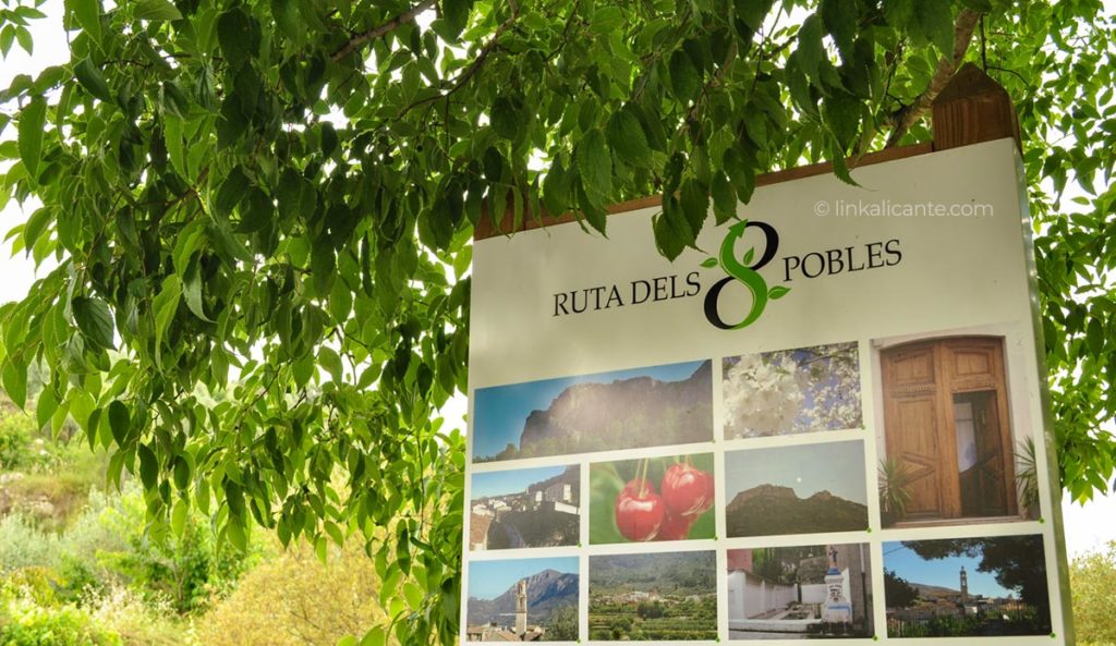
After a short break, we continue discovering the Vall de Gallinera with the Ruta dels 8 Pobles . I remind you that it is a linear route of about 16 kilometers, which will take us to know the 8 small towns distributed within this elongated valley in the interior of the Marina Alta .

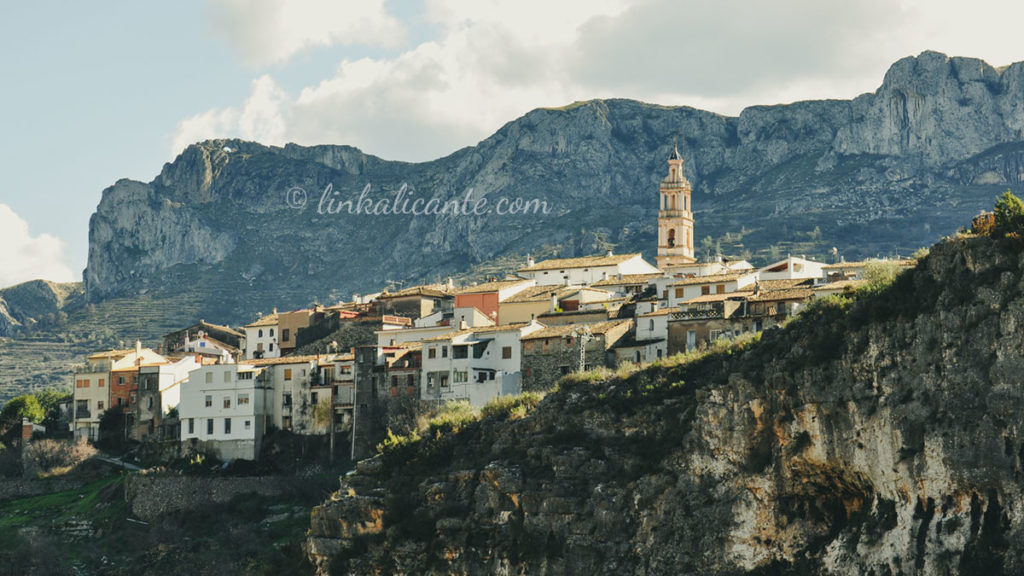
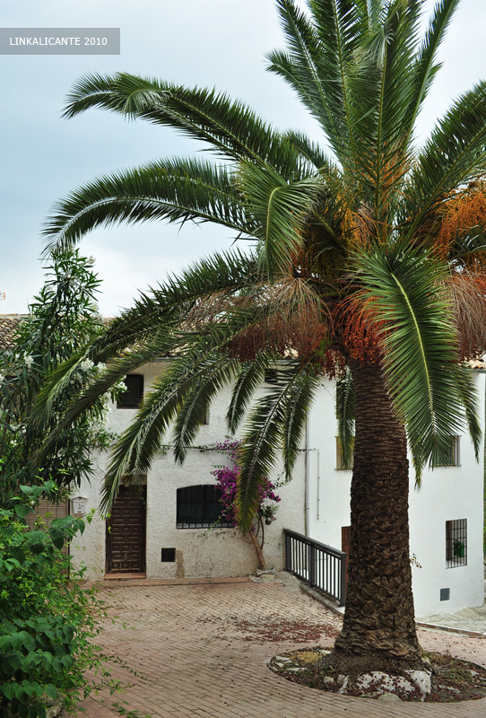
Bottom photo: Benissili , the last town on the route.

Route of the 8 towns - Vall de Gallinera

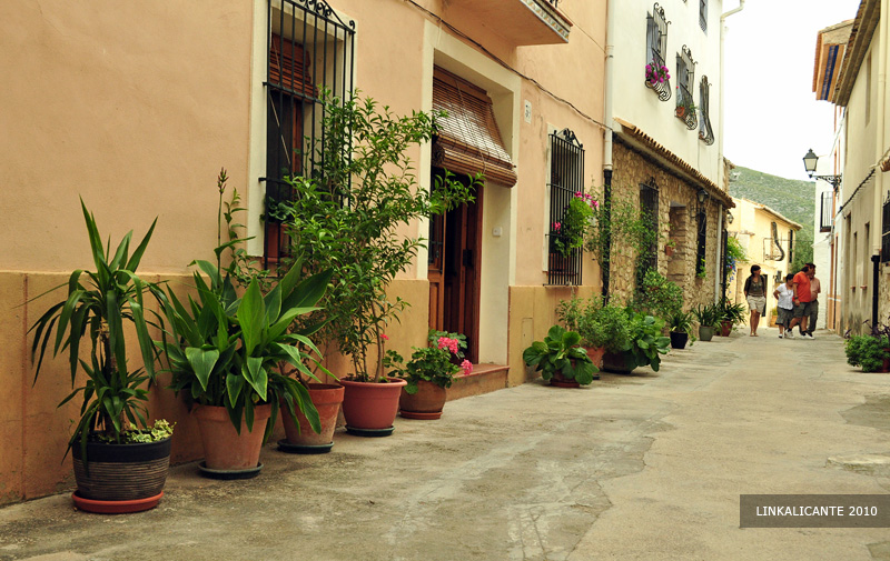
After crossing Benirrama, Benialí, Benissivà and Benitaia in the first part of the route, we now reach the fifth town: La Carroja .

La Carroja, la Vall de Gallinera

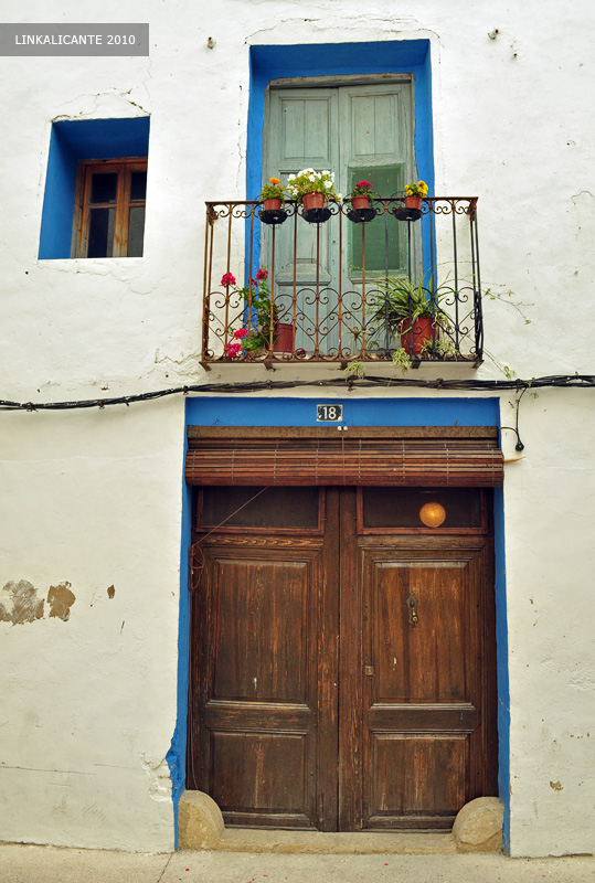
Personally, this town was one of the ones I liked the most. As in many others of Moorish origin, the ornamentation with flowers and plants stands out on the doors of the houses, balconies and windows. I’m sure the interior patios will also be fantastic, a shame we couldn’t visit any of them.

Route of the 8 towns, Vall de Gallinera

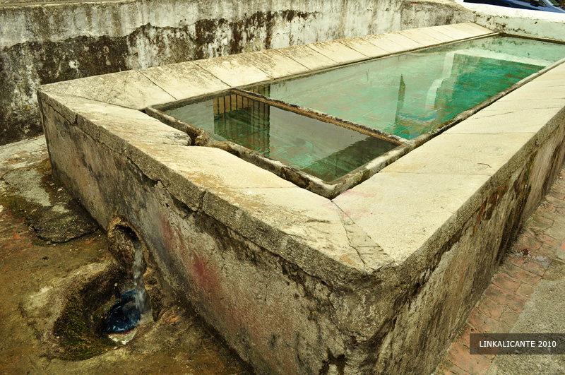
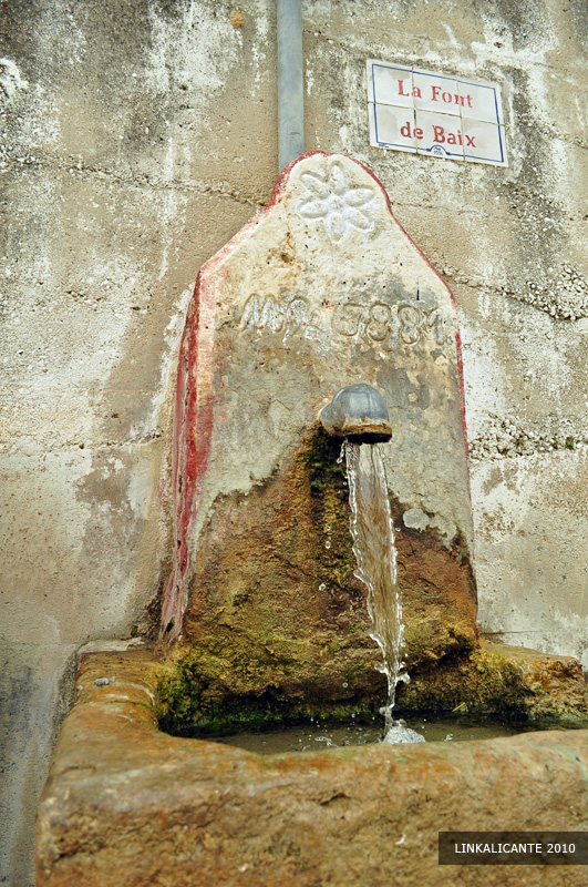
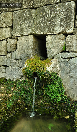
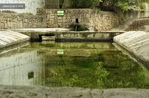
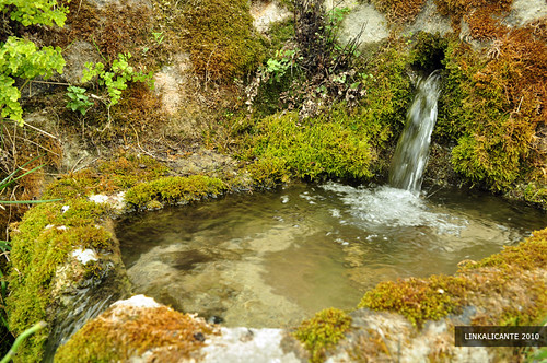
In La Carroja, we visit the Font de Baix, before continuing on our way to the next town on the route: Alpatró.

Font de Baix, La Carroja, Vall de Gallinera

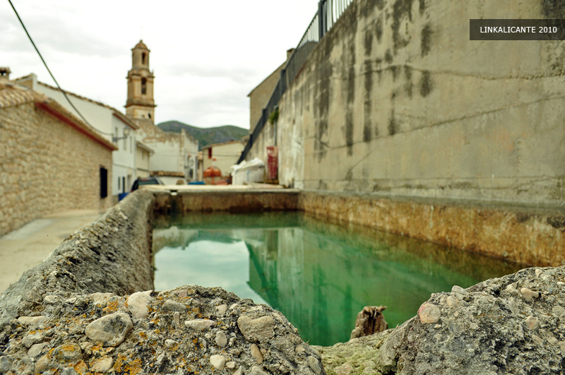
The pool next to the Font de Baix, with the church of La Carroja in the background.

Font de Baix, La Carroja, Vall de Gallinera

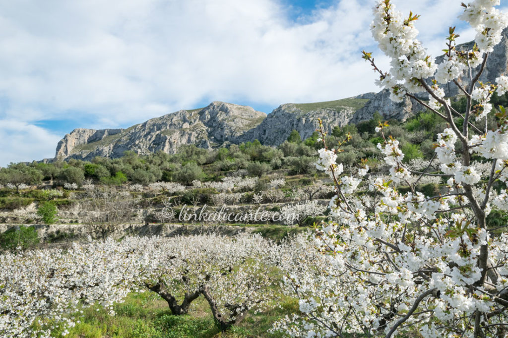
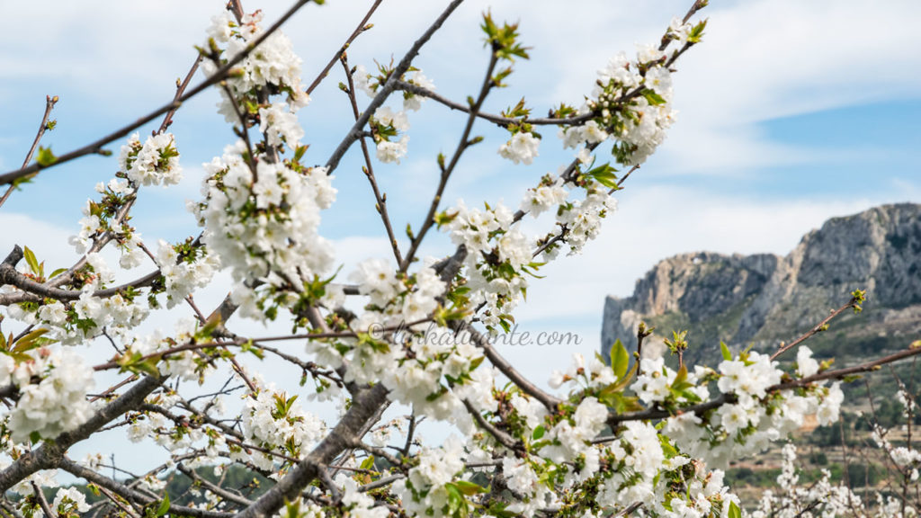
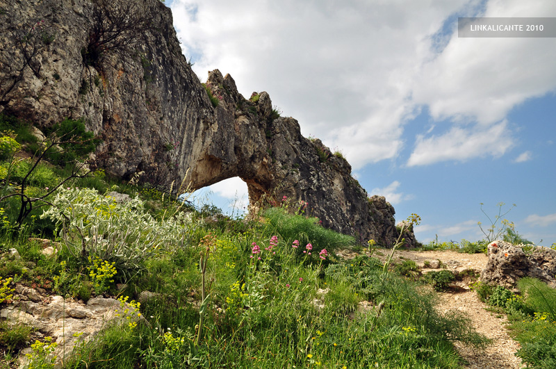
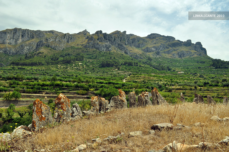
After leaving La Carroja , the route moves away from the asphalt. We take a path that ascends between terraces of cherry trees. We approach the foothills of the Serra Foradà . This section of the route is the least ‘urban’ of the entire route, and will allow us to enjoy the wildest Gallinera.

Route 8 towns

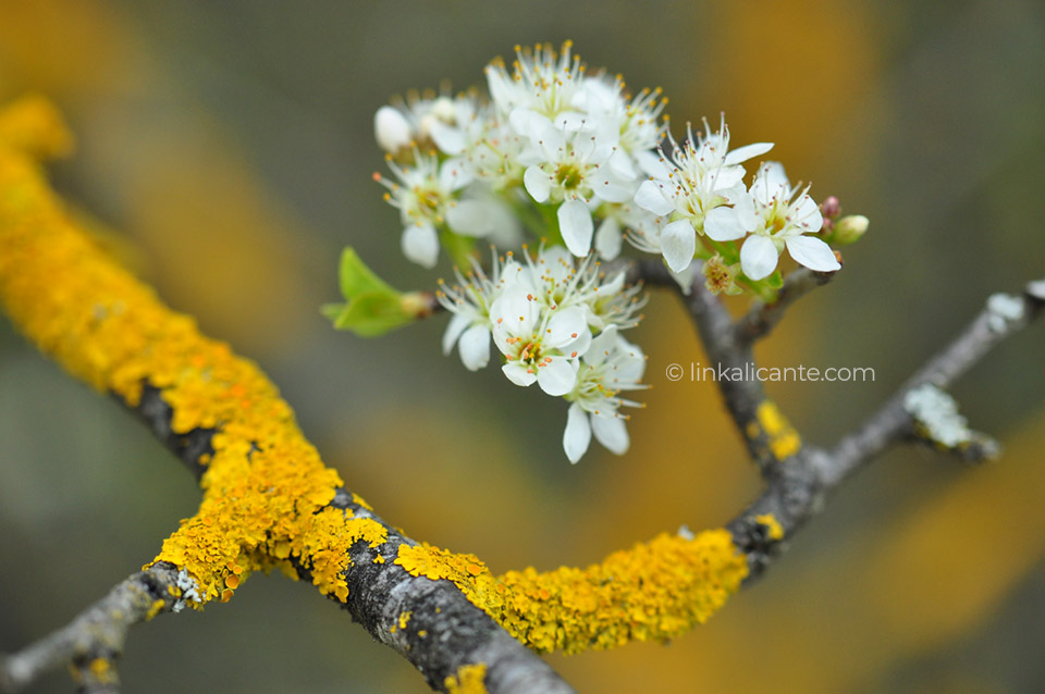
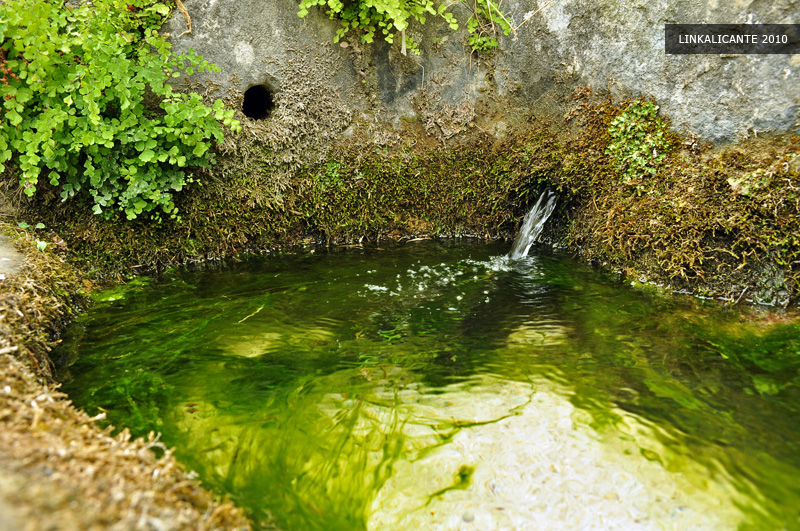
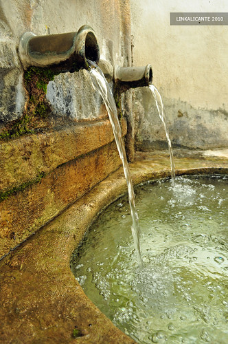
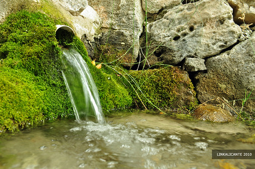
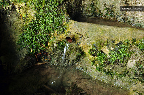
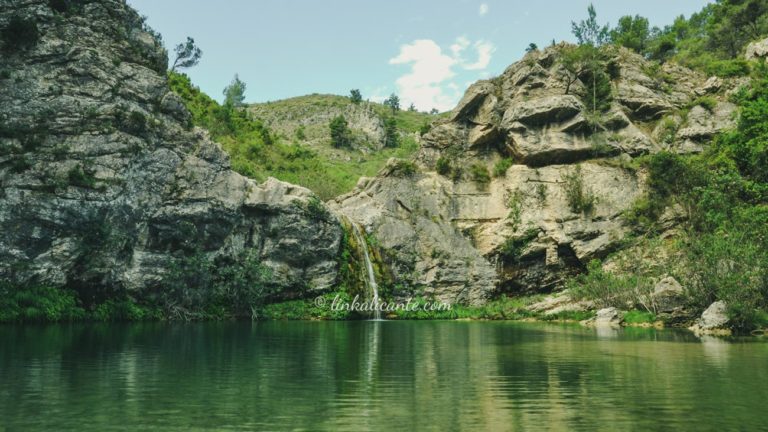
In this part of the route we visit two fountains: the Font d’En Pere and the Font de l’Orenga . Unfortunately, I skipped the first one, so I’ll show you the Font de l’Orenga below. Without a doubt, it is one of the most ‘wild’ fountains on the route.

Route 8 towns

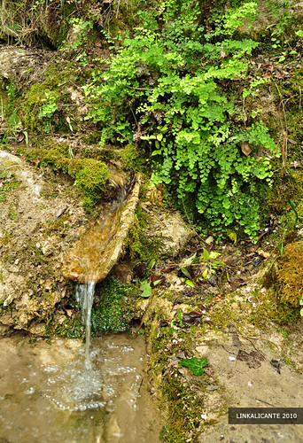
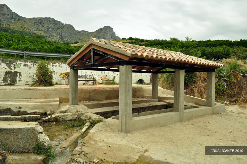
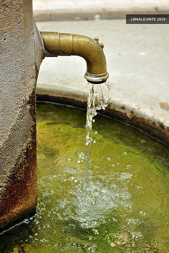
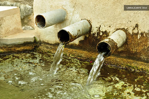
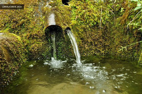
After passing by the Font de l’Orenga, the trail descends again in search of the main road, reaching it next to the following fountain: La Font Vella d’Alpatró , which I show you in the following photo:

Vall de Gallinera

Next to the fountain, the washer. Judging by its size, it must have been one of the most important in the valley (in fact, Alpatró is the largest of the 8 towns today).

8 towns walk

And we arrived at Alpatró, the sixth town on the route, and one of my favorites…

8 towns walk

We cool off at the Font d’Alpatró , in the town square, next to the church.

8 towns walk

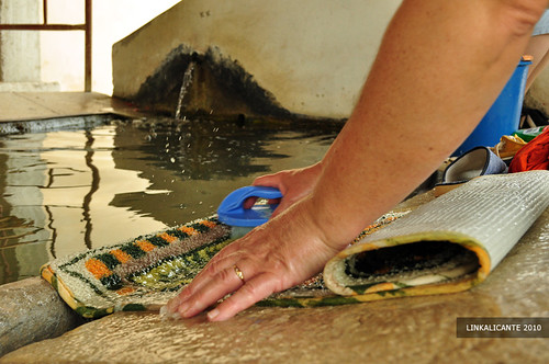
And at the exit of it, we visited his washer. Although it is currently being rebuilt (not very tastefully, in my opinion), I find a couple of people there who are washing shoes and carpets. A testimony of past times, in which these washers brought together a good part of the women of the town.

Route 8 towns

We leave Alpatró towards the next town: Llombai . This section of the route, to Benissili, runs along a paved road .

8 towns walk

At the entrance to Llombai, which is currently uninhabited, we can see the old mill. At the end of the town, which consists of a single street, is the fountain with three spouts and the washing machine. There I get a somewhat unpleasant surprise: a married couple washes their car next to the fountain. No comment.

8 towns walk

Both the fountain and the sink have been recently remodeled, losing part of their charm to my liking. Let’s be careful with these reconstructions, there is a cultural heritage at stake.

8 towns walk

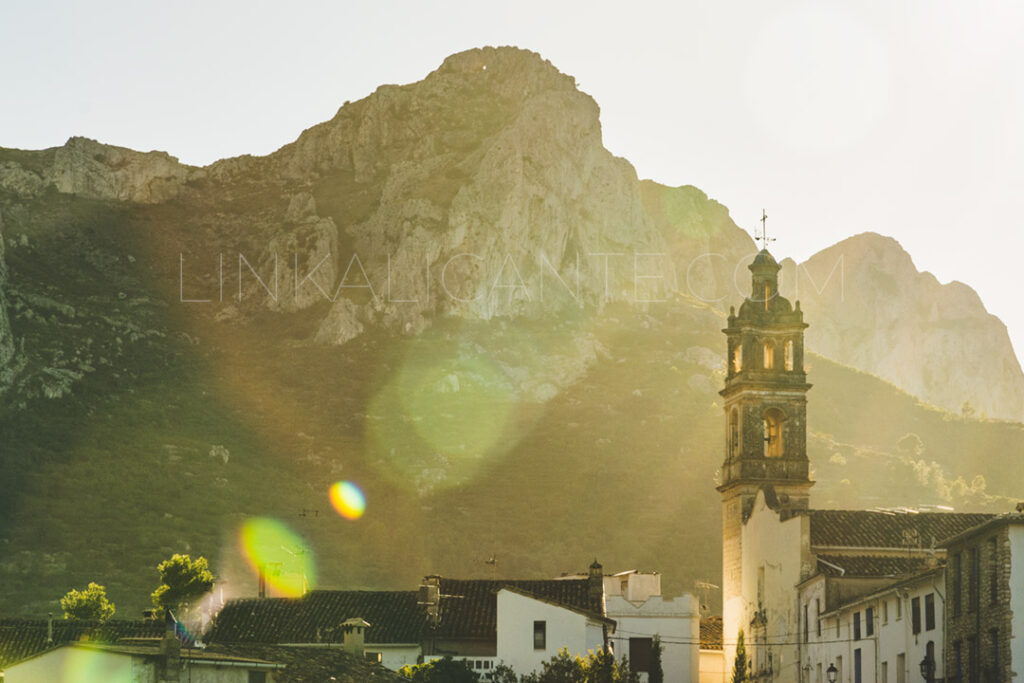
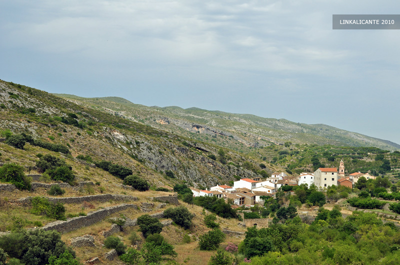
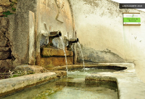
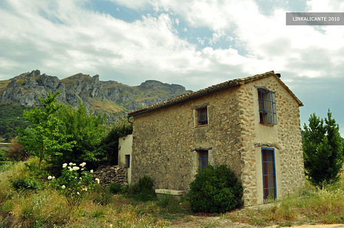
And finally we arrive at Benissili , the last town on the route. The highest of all, and possibly also my favorite. Benissili belonged to the nearby Vall d’Alcalà until the 19th century.

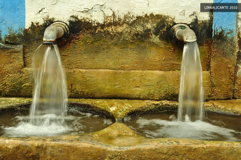
Going up some stairs, we enter the heart of the town, reaching the washing machine and its attached fountain, with two spouts.

8 towns walk

I am fascinated by these old fountains and sinks… don’t you?

8 towns walk

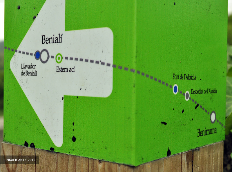
We leave the town in search of the last fountain on the route: La Font de la Mata . We can continue along the road, or take a path (rather poorly signposted, by the way) that passes next to Despoblat de la Solaneta.

8 towns walk

We reach the Font de la Mata, where we once again take the opportunity to refresh ourselves with its icy waters (yes, even in summer) and eat something in the shade of the poplars. Test passed, we have completed the route!

Ruta 8 pobles

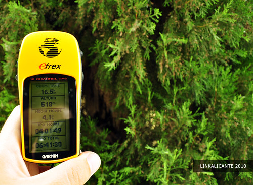
So far, it’s been about 16 kilometers. Now we have to return to Benirrama. A good option may be to leave a car at this point at the beginning of the day.

8 towns walk

Walking back towards Benissili, we find new corners that never cease to amaze us. At the bottom of the lower photo we can see the Castell de Benissili , guarding the entrance to the valley from above.

8 towns walk

And here, next to the road, the murmur of the water leads me to discover a new source that I did not count on. The Font Vella of Benissili? It could be, I’m not sure. In any case, I find it as captivating as all the others.

8 towns walk

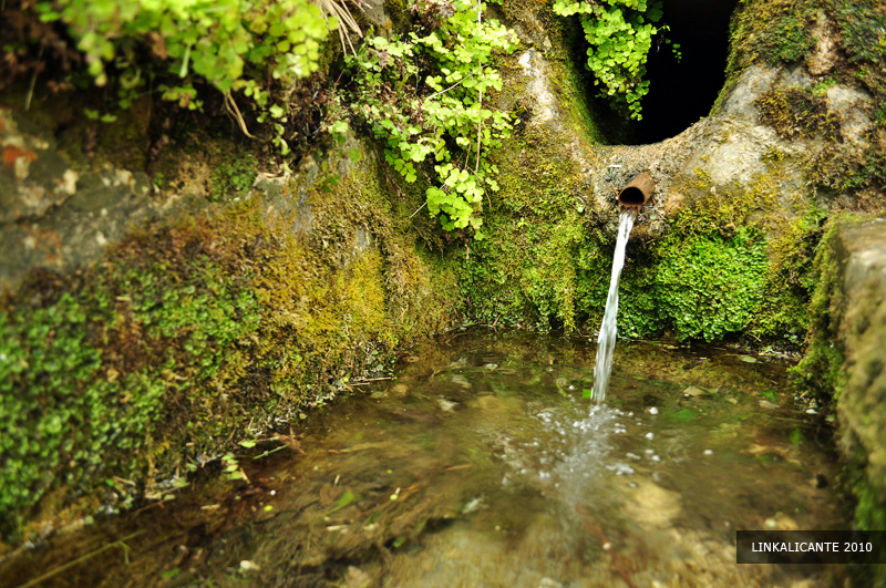
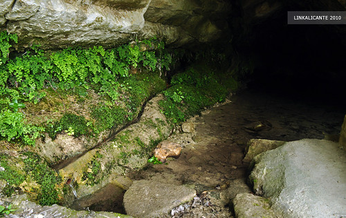
Back in Benirrama, taking advantage of the last hours of the day, I decide to follow the beginning of the route, which I had ruled out at first. This is how I arrive at the Font de Benimarsoc , where the water is born in a cave. Impressive, it seems that this day will not stop surprising me.

Ruta 8 pobles

Ruta 8 pobles

And finally, although it should be the first, we arrive at the Font de la Mata de Benirrama, the true starting point of this route.

8 towns walk

And since we are at the beginning, I think it is time for you to go through it for yourselves … what are you waiting for? I promise you it won’t disappoint you.

Track for GPS

Below you can see the GPS track of part 1 of the Route of the 8 Towns. Although the route is signposted, if you wish you can follow the route through the wikiloc application.

Powered by Wikiloc

Article originally published in LinkAlicante in July 2010, and updated in June 2020.

Related Routes in LinkAlicante
Route of the Penya Foradà of Vall de Gallinera
Hiking Routes in La Vall de Gallinera

La Vall de Gallinera, hiking trails in the “lost paradise” of Alicante Nature, history, culture and “supernatural” phenomena inside the Marina Alta. La Vall de Gallinera is a little “lost paradise” inside the Marina Alta. A beautiful valley in the

Dinos si te ha gustado

1 estrella2 estrellas3 estrellas4 estrellas5 estrellas 5.00 / 5 (1 votos)

Buenas Prácticas

• Sigue siempre los senderos. Atajar daña el entorno.
• Respeta flora, fauna y entorno. Disfruta en Silencio.
• No dejes rastro de tu paso, tampoco restos orgánicos.
• Infórmate, Planifica y Equípate bien para disfrutar al máximo.
• Respeta el Patrimonio Cultural (ruinas, márgenes de piedra, etc).
• Respeta a otras personas y propiedades privadas.

Leave a Comment

Your email address will not be published. Required fields are marked *

This site uses Akismet to reduce spam. Learn how your comment data is processed.

Scroll to Top