Cruz de la Muela (Sierra de Orihuela), Vega Baja viewpoint

Cruz de la Muela, Sierra de Orihuela

The Cruz de la Muela, besides being a fantastic viewpoint of the region of the Vega Baja del Segura, is a cultural symbol for the city of Orihuela and its surroundings. This popular 465-meter high watchtower is regularly visited by hiking and trail running enthusiasts, as well as religious pilgrims.

In this article you will learn all the details about the hiking route to climb the Cruz de la Muela. In addition, we tell you some curiosities that you probably did not know about this iconic monument. Let’s start!

The Orihuela Mountains: nature and heritage

Cruz de la Muela, Sierra de Orihuela
La Cruz de la Muela desde la distancia

The Sierra de Orihuela is a mountainous formation located in the region of the Vega Baja, south of the province of Alicante. Its highest elevation is the Peña de Orihuela or Leja Millamón, 634 meters high.

From a geological point of view, the mountain range is composed of dolomitic limestone blocks from the Triassic (wikipedia). Like the nearby Sierra de Callosa, despite its moderate height, it is a steep and rugged mountain formation, with countless climbing routes, a fact that corroborates its rugged terrain.

It may seem a barren and sterile environment, but the truth is that the Sierra de Orihuela is a protected area at European level within the Natura 2000 Network. This is due to its environmental valuesThe presence of birds of prey is one of the most important, and for this reason it is ZEPA (Special Protection Area for Birds) and its floristic singularities, with endemic, rare and endangered plant species, which is the reason why it is LIC (Site of Community Interest).

From the point of view of cultural heritage, it is worth mentioning the presence of old iron mines and , according to some testimonies, also small gold mines. In addition, the extraction of gypsum and limestone was common in the sierra and some quarries are still active.

Route Summary

cruz-muela-sierra-orihuela-005
Vistas desde el Cabezo Cruz (496 m.)

Classic ascent to the Cruz de la Muela from the Montepinar urbanization. Return by the Senda de las Minas, climbing before to the Cabezo Cruz (496 m). We follow different variants of the PR-CV 59.

Route to the Cruz de la Muela

Ruta Cruz de la Muela - Sierra de Orihuela
Vistas hacia la Sierra de Callosa desde la subida

The Sierra de Orihuela extends east-west along more than 11 kilometers, so that its western end culminates in the neighboring Region of Murcia. The northern slope is crisscrossed by countless ravines, while the sunny side is characterized by large limestone rock walls of orange tones.

The Cerro de la Muela, popularly known as Cruz de la Muela, is the highest secondary peak at the eastern end of the sierra, at 465 meters high.

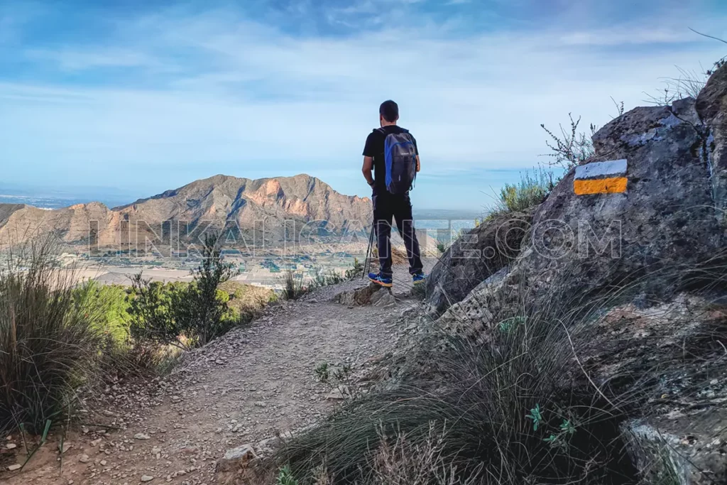
The classic uphill route starts in the Montepinar urbanization, following the marks of the PR-CV 59 short-distance trail -small is an understatement in this case, especially because of the infinite number of variants that this itinerary has-.

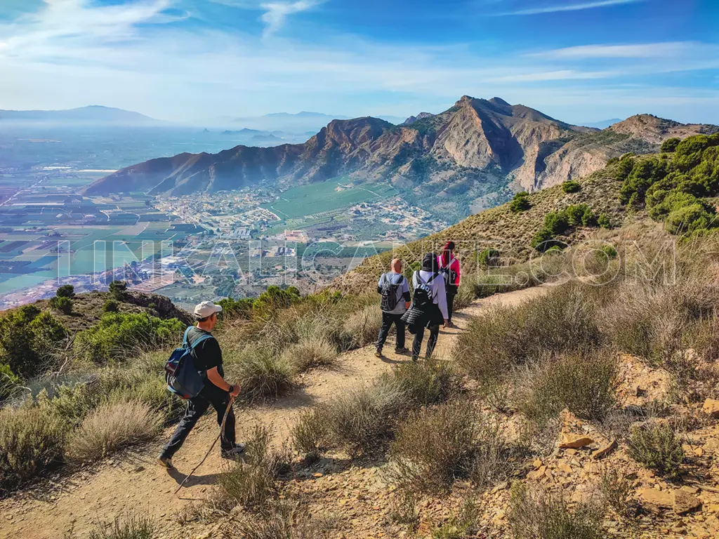
The classic ascent is very busy and we will find many people walking or running up and down it. The path ascends in large loops, looking for the most suitable route between multiple ravines and hills, frequently changing slopes, which makes it very attractive. Along the climb there are flat stretches that allow you to catch your breath before tackling the next steep climb.

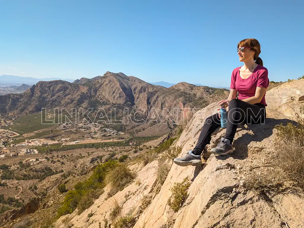
This is how we arrived at the Collado de la MuelaFrom this point we face the easy final climb up and back to the huge cross, an excellent viewpoint from which we can see the city of Orihuela, the meager and canalized Segura River meandering through the alluvial plain and a good part of the region. It is worth stopping to contemplate the scenery while regaining strength with a snack.

PR-CV 59 Cruz de la Muela, Orihuela Mountain Range
Views towards Peña de Orihuela from Collado de la Muela

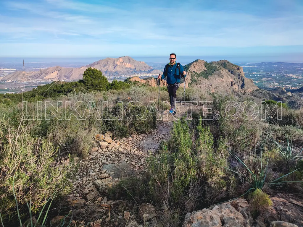
To continue, we will look for a circular route walking in a westerly direction, towards the Cabezo Cruz ( 496 m.), another of the secondary peaks of the sierra, to which we will also ascend in a round trip section.

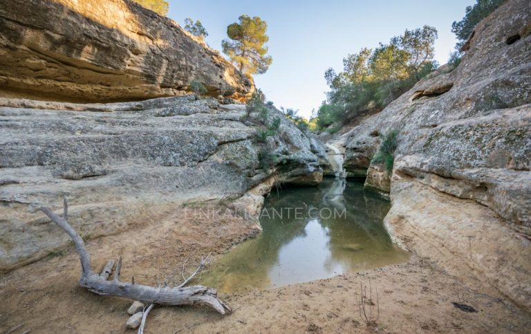
The descent is made by the Path of the Mines through the ravine of the same name, a zigzagging and interesting descent that brings us closer to the history and the hard lives of the miners who worked in the mountains, whose paths we travel today also with effort and sweat, but for radically different reasons.

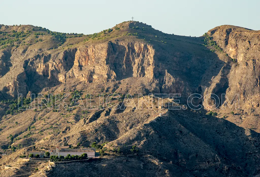
Already down, after passing by the Hermitage of Nuestra Señora del Pilar, we conclude the circular route through the streets of the Montepinar urbanization.

Data sheet

History of the Cruz de la Muela

According to some documents, the history of the Cruz de la Muela dates back to February 26, 1411. In other words, more than 600 years of history. Apparently, the cross was erected in its location to commemorate a visit of San Vicente Ferrer to Orihuela, where he preached in different temples.

At the foot of the cross a blessed palm was placed while praying for good harvests, since agriculture has been the economic engine of the Vega Baja for centuries. But the chronicles also say that after the symbol was placed “blasphemy ceased, peace was signed between families or opposing sides, brothels were closed, and people clamored against adultery or gambling”.

The original cross was made of wood, so it was destroyed by the weather -or the hand of man- on several occasions. It is in 1910 when the first iron cross was placed, with an aspect that would be similar to the current one. As we are told in Alicante Vivo, the cross that we can see today dates from 1985, since in that year the previous symbol was sawed and thrown into the void, so it had to be replaced (by a helicopter of the Air Force).

Also in Alicante Vivo we detail that the Cruz de la Muela has a height of 14.80 meters by 8 meters wide, with a weight of 1200 kilos.

As a curiosity, in 2014 the Supreme Court had to intervene to prevent the removal of the cross, as we are told here.

Whatever its origin, there is no doubt that over the years the Cruz de la Muela has become a symbol for Orihuela and the region of La Vega Baja.

Track for GPS

On this occasion I recorded the track with the Suunto 9 Peak Pro, which is why I have not added waypoints. I have a similar track where I go through the Senda del Burro and Los Agujeros (more difficult because of the steep terrain).

Do not miss...
Dinos si te ha gustado

1 estrella2 estrellas3 estrellas4 estrellas5 estrellas (Sin valorar todavía)

Buenas Prácticas

• Sigue siempre los senderos. Atajar daña el entorno.
• Respeta flora, fauna y entorno. Disfruta en Silencio.
• No dejes rastro de tu paso, tampoco restos orgánicos.
• Infórmate, Planifica y Equípate bien para disfrutar al máximo.
• Respeta el Patrimonio Cultural (ruinas, márgenes de piedra, etc).
• Respeta a otras personas y propiedades privadas.

Leave a Comment

Your email address will not be published. Required fields are marked *

This site uses Akismet to reduce spam. Learn how your comment data is processed.

Scroll to Top