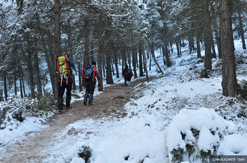
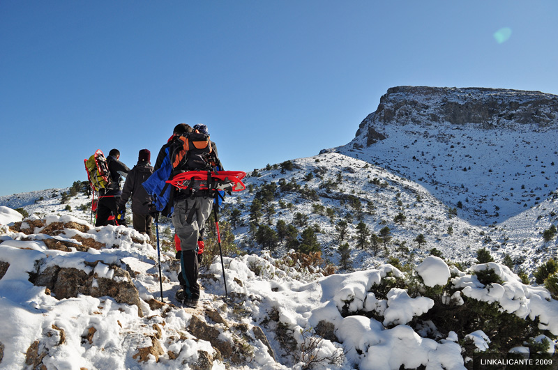
On this occasion, we let ourselves be guided by Luis Calvente , a great connoisseur of Mariola, his “natal mountain range”. Raúl Sáez and the group “Los Senditos” accompany us. All equipped with leggings, and some with snowshoes in the chamber.
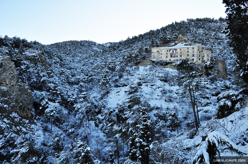
We start the tour in the steep streets of Agres , a town that is worth visiting carefully. We are on the north face of the Serra de Mariola . The white blanket of snow covers everything. When we start walking, it is already 10 in the morning, but it is still intensely cold. On leaving the town, we find the impressive Mare de Déu d’Agres Sanctuary . The snowy landscape makes the picture even more spectacular.
The section ahead of us is a steep climb, from the Sanctuary, at about 800 meters, we will climb to 1,200 where the Santiago Reig del Moral Refuge is located. All in just a couple of kilometers.
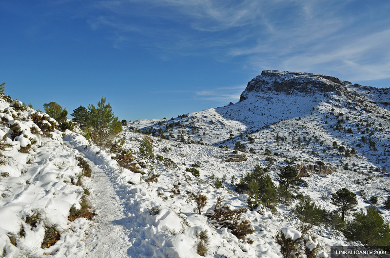
The climb, as I said, runs along the north face of the mountain range (which makes it difficult to take pictures). The thickness of snow reaches 20-30 centimeters in some places. The trail is well trodden, and in many areas the snow has turned to slippery ice.
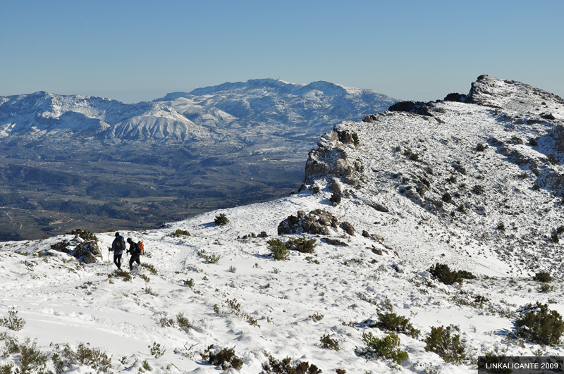
As we gain height, mountains appear behind us, to the north. In the lower photo, we can see Benicadell , also covered in snow. To the left, the summit of Mondúver stands out, beyond Gandía.
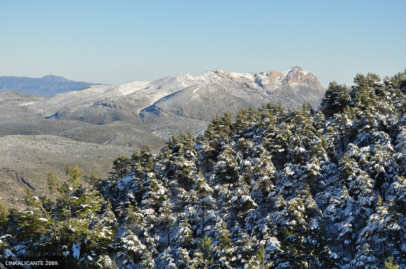
But the view reaches much further. Although my lens could not capture it, we were able to appreciate the silhouette of Penyagolosa, in the province of Catellón. About 160 kilometers from a bird’s eye view. Almost nothing.
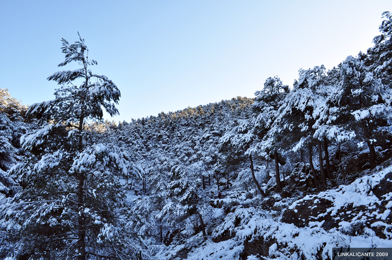
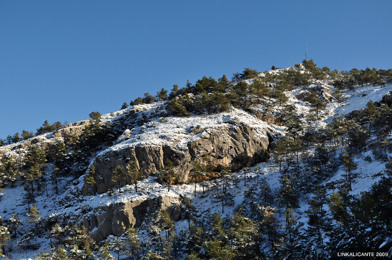
We continue climbing between pines. Opposite we see the Pico Teix (1,264 m), crowned by the antennas.
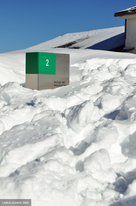
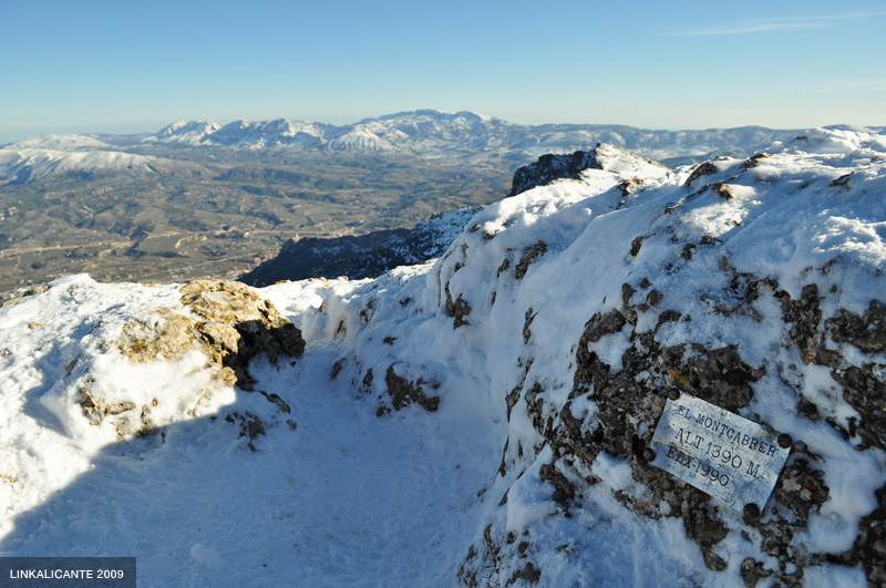
Finally we arrive at the “ Refugi Montcabrer ” (it is the refuge that I mentioned before). We leave the shady area, the rays of the sun welcome us, although it is still cold. We take the opportunity to have a snack before continuing towards the Cava de l’Habitació , a few meters from the refuge.
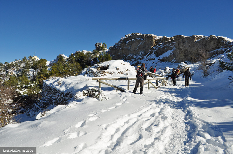
Next to the shelter, the metallic indicators can give us an idea of the amount of snow that accumulates in some points. In this case, there could very well be half a meter of snow.
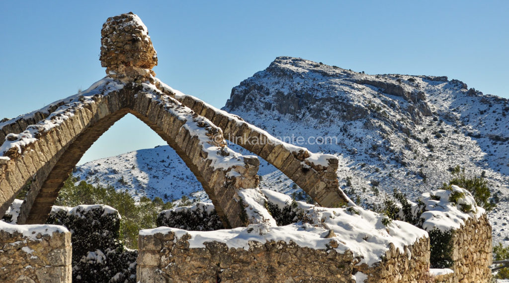
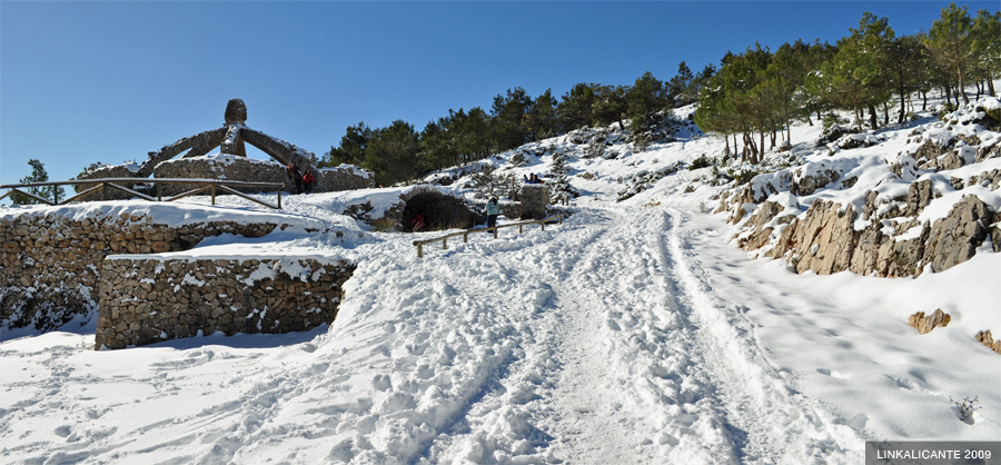
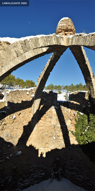
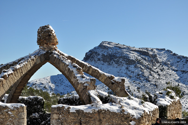
We continue the route, towards one of the strong points of the day: La Cava Gran or Cava Arquejada . An obligatory stop to take photos and marvel at this impressive testimony of past times. With the landscape covered in snow, it is even more impressive.
According to wikipedia, it has a depth of 12 meters and a diameter of 14.90. It is one of the largest (and best preserved) in the province.
The lower photographs show the silhouette of the Montacabrer peak in the background, with Cava Arquejada in the foreground. A characteristic picture of the Serra Mariola.
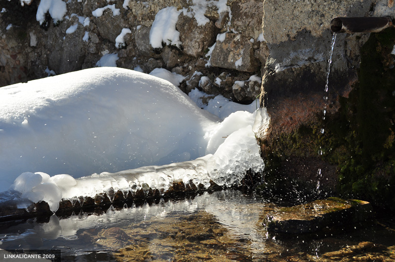
Next to the Cava, a trickle of water drips incessantly, trying to resist freezing…
It is time to continue towards the top of Montcabrer.
Bottom photo: panoramic view from the pass with views of the entire El Comtat region (click on the photo to see it enlarged).
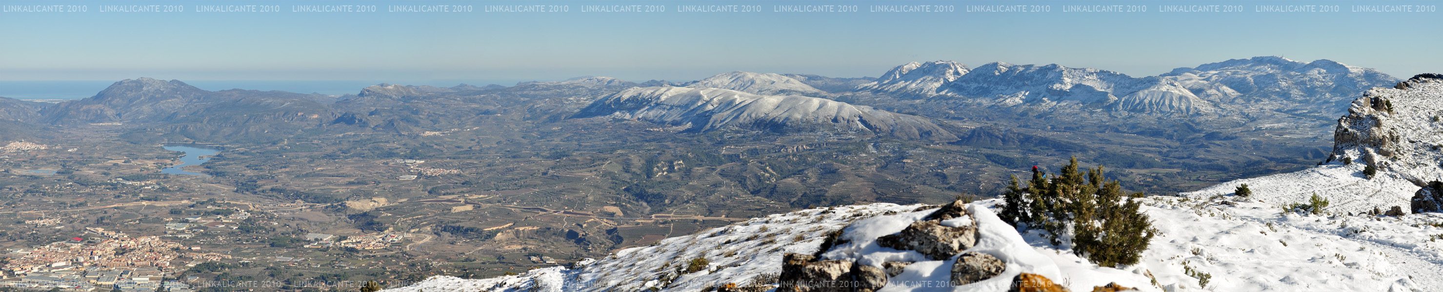
It is a panoramic composed from 6 photos. Views from the Sierra de Aitana (right), Sierras de Serrella, Almudaina, Alfaro, and La Safor, after the Beniarrés Reservoir. On the horizon, on the left, the Mediterranean Sea can be seen perfectly.
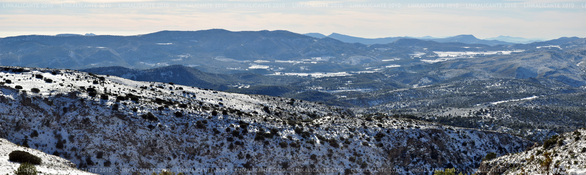
And another panoramic view, this time of the Font Roja area. If you see it enlarged, you will be able to discover details such as: the Sanctuary of the Font Roja, the Despeñador peak, the Replana, the Sierra del Cid or the Cabeçó d’Or. I encourage you to find them!
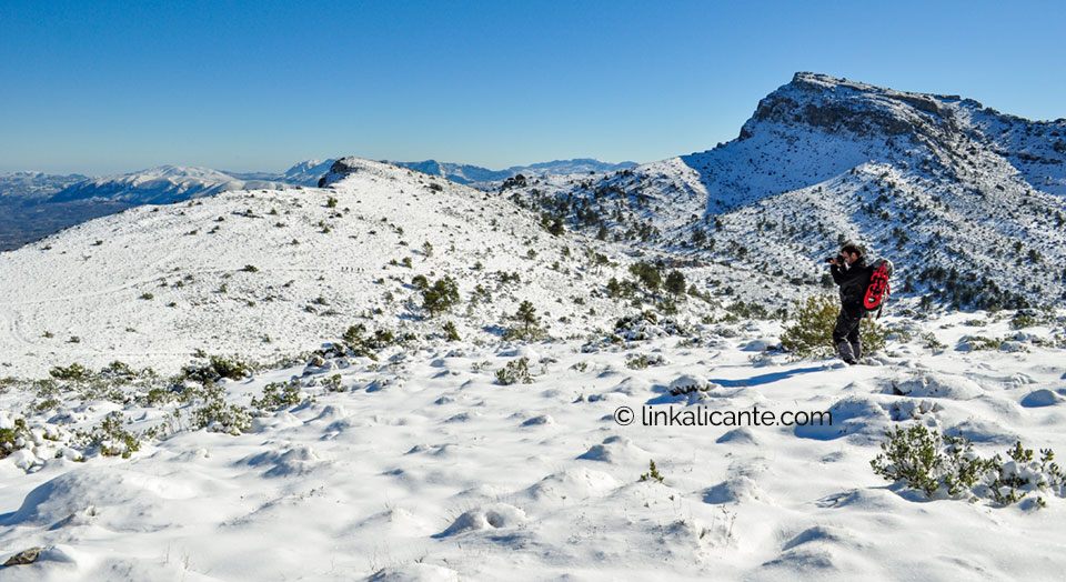
After passing the Peñas Montesas pass (on the right side of the bottom photo), we are very close to the top of Montcabrer…
Finally, we reach it: 1,390 meters above sea level. The third summit in Alicante, after Aitana and Puig Campana. Needless to say it was worth it. Every step.
At the top a light wind blows, enough to sharpen the feeling of cold. We eat just enough to replenish our strength, and quickly begin the descent.
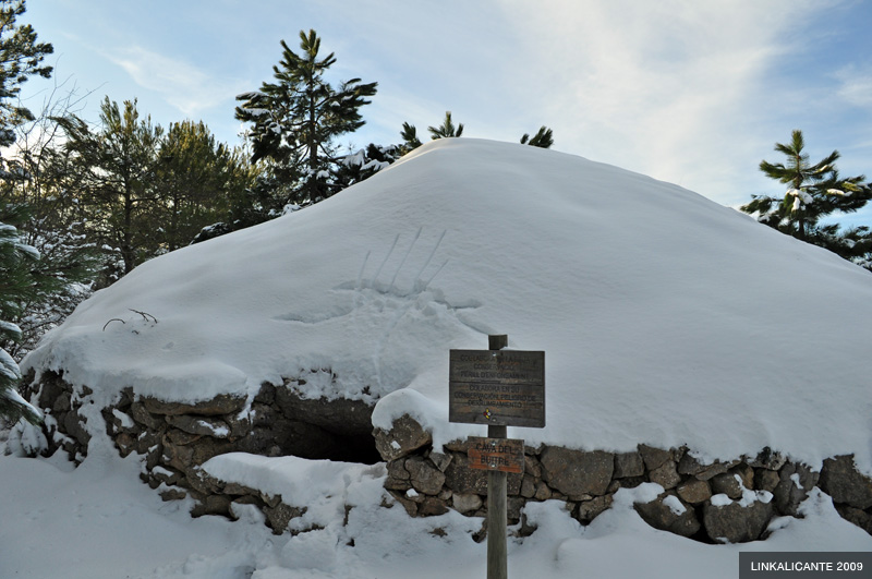
We return to Cava Arquejada, and from there Luís leads us to Cava del Buitre . It is a lesser known path, and one that has not been traveled all day. The fact of stepping on “virgin snow” sharpens the feeling of adventure. It is really hard to believe that we are in Alicante…
In the last part of the route, we return to a forest track in the direction of Agres . It would be a pretty normal path without snow, but the white blanket totally transforms it. We hurry the last hours of the day, which we have enjoyed to the fullest, like children.
Finally, and almost at night, Agres appears before us. The end of the adventure. Luckily, we are sure that it will not be the last…