 32")
 33")
Con una altura de 1557 metros, la Sierra de Aitana es la máxima elevación de la geografía alicantina. La «Sierra Madre» de la provincia, como algunas personas la llaman, alberga diferentes ecosistemas de gran valor ambiental, protegidos por microrreservas de flora, así como la figura europea LIC (Lugar de Interés Comunitario) y ZEPA (Zona de Especial Protección para las Aves), dentro de la Red Natura 2000.
 34")
Desde el punto de vista del patrimonio cultural, los antiguos pozos de nieve de Aitana son uno de sus elementos más destacados, testigos del comercio del frío en siglos pasados, siendo el origen de muchos caminos de herradura que hoy en día utilizamos en nuestras rutas de senderismo.
 35")
Comenzando en el área recreativa de la Font de Partegat, ascendemos por pista forestal, entre bancales de almendros, hasta llegar a un caos de bloques donde el camino se convierte en senda. Una subida constante pero llevadera, con un tramo final por pista, nos deja en el rellano donde se asienta la Font de Forata, la más alta de la provincia de Alicante, a casi 1400 metros de altura.
Desde la fuente, nos acercamos hasta la base del Passet de la Rabosa, un paso algo técnico que exige superar una trepada y atravesar una grieta entre grandes peñascos. Así llegamos a las impresionantes Simas de Partegat, colosales tajos en la montaña que evidencian su lento pero incesante desplome hacia el valle.
 36")
Desde el rellano junto a las simas, ideal para reponer fuerzas, tomamos la senda que asciende por el cordal, superando un último repecho hasta coronar el «techo» accesible de la provincia Alicante.
Para buscar el recorrido circular, regresamos a las simas y desde allí seguimos la cresta de la sierra en dirección Este, caminando por un terreno incómodo debido a las afiladas formaciones kársticas. Finalmente abandonamos la cresta por una pronunciada bajada que nos deja en el Port de Tagarina. En este punto enlazamos con la pista forestal que, en descenso constante, nos llevará de vuelta a la Font de Partegat.
 37")
 38")
 39")
 40")
 41")
 42")
 43")
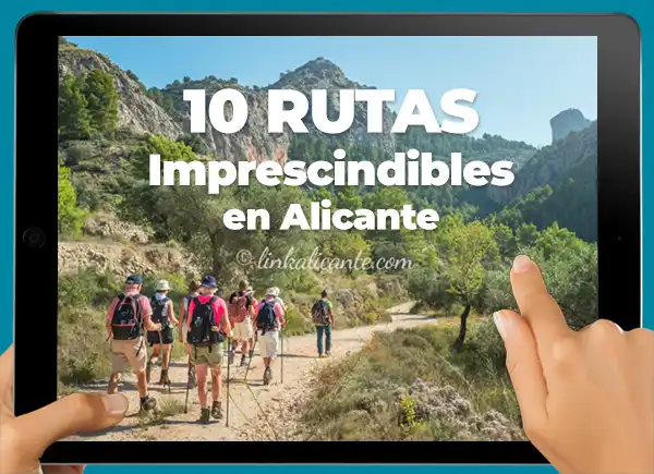
Ruta alrededor del Embalse de Guadalest, el corazón esmeralda de Alicante
11 km y 400m. D+ en una ruta sencilla, ideal para todos los públicos, en la que podrás también conocer el pueblo de Beniardà y saborear su rica gastronomía.
 44")
Cumbre de la Sierra de Aitana con nieve, marzo 2011
Es habitual que la Sierra de Aitana se cubra de blanco cada invierno, aunque lo normal es que la nieve solo permanezca en las partes más altas durante unos pocos días. Los espesores pueden alcanzar los 50 centímetros o más.

Que bonitas esas fotos de la nieve y los almendros en flor… precioso contraste que por desgracia nos anuncia una mala cosecha de almendras para este año. Lo de la basura es una pena, esas visiones son las que me hacen replantearme muchas veces si hacemos bien en difundir en nuestros blogs la belleza de nuestra tierra. Por cierto, seguro que la cara norte de Serrella tenía bastante nieve.
saludos!
Gran día de senderismo y muy buenas la crónica y las fotos, sobre todo las que salimos nosotros. ;)
Que pasada de fotos, la verdad es que me ha picado el volver a hacer senderismo.
Saludos!
Pingback: 10 Ascensiones clásicas de la provincia de Alicante - LinkAlicante
Me parecen alucinantes tus fotos. Estamos en la zona y me da envidia hacer esa ascensión con nieve
Muchas gracias! La ascensión a Aitana desde Partegat después de una nevada gana muchos puntos!
Un reportaje detallado y excelente acompañado de unas hermosas fotos. Me ha sido muy útil. Hice esta ruta desde Benifato hace cuatro años.
Muchas gracias, Agustín, me alegra que te haya gustado. Un abrazo!
Hola Fernando, hui hem anat a la font de Partegat per la carretereta que puja des de Benifato i l’han asfaltat, es pot pujar en cotxe sense problemes i sense preocupacions. Salut i muntanya.
Moltes gràcies per l’avís, Ignacio, prenc nota!