One of the most beautiful and spectacular routes in Valencia is the Ruta de los Pantaneros or Ruta de los Puentes Colgantes de Chulilla.
It is a very simple excursion that can be done with children (always supervised), about 9 kilometers long; half of it if we only go to the 2nd bridge.
In addition, the town of Chulilla, just 1 hour from Valencia city, has many other routes and charming places to visit, such as its castle or the Charco Azul, making it ideal for a weekend getaway.
Stay until the end to know all the details of the Hanging Bridges Route and other attractions of Chulilla. Let’s start!
Don’t miss: The Best Routes in Valencia.
Índice del Artículo
ToggleHike Overview
This hike begins on the edge of the urban area of Chulilla in the direction of Losa del Obispo, next to the CV-394 road.
You can try to park next to the viewpoints, although my advice is to use the public parking of the village (below I leave the location) and walk along the road (only 500 meters).
Keep in mind that there is a fee of 1€ (every day) to access the route and you will see that it is usually very crowded, especially on weekends and holidays.
The first point of interest are the spectacular viewpoints of the Turia Canyon, located on the edge of impressive vertical cliffs.
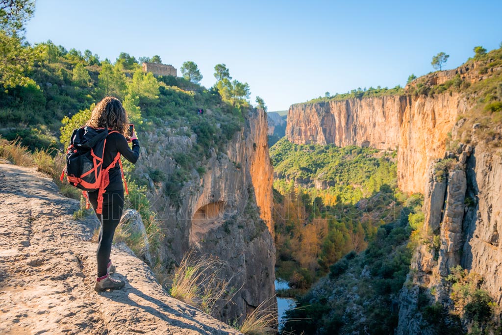
From there, the trail goes along the edge of the ravine until it reaches Los Calderones, which gives its name to the whole area. It continues bordering with a slight ascent until it reaches the first suspension bridge, the highest one.
After crossing the bridge there is a descent by stairs and a flat stretch until reaching the second suspension bridge, also in a spectacular setting. If you want, you can continue to the Loriguilla reservoir, a much less crowded area of the route.
The normal way is to return the same way, although I leave a circular alternative (longer) at the end of the article.
ROUTE SHEET
- Difficulty: Easy.
- Suitable for Children: +7 years old. Always under surveillance.
- Linear route (round trip)
- Only bridges route: 4 km
- Complete distance: 10 km
- Slope: 300 m.
- Estimated time: 3 - 4 hours
- Fee 1€ and Parking 4€.
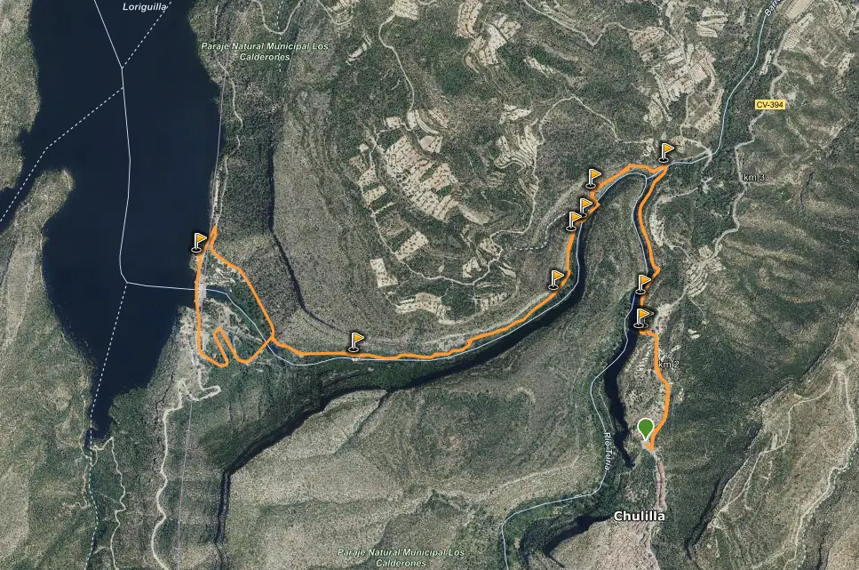
Track for GPS
The Route of the Pantaneros or Route of the Hanging Bridges of Chulilla is signposted and has information panels. The normal thing will be that you meet quite a few people along the route and it really is not lost. In any case, below you can download the track for GPS via wikiloc:
Detailed description of hike
Today’s route will take us into the impressive Turia River Canyon , which describes two pronounced meanders – the sickles – in this area. We are in a natural area protected by the Generalitat Valenciana: Los Calderones Municipal Natural Area , of great environmental, landscape and cultural value.
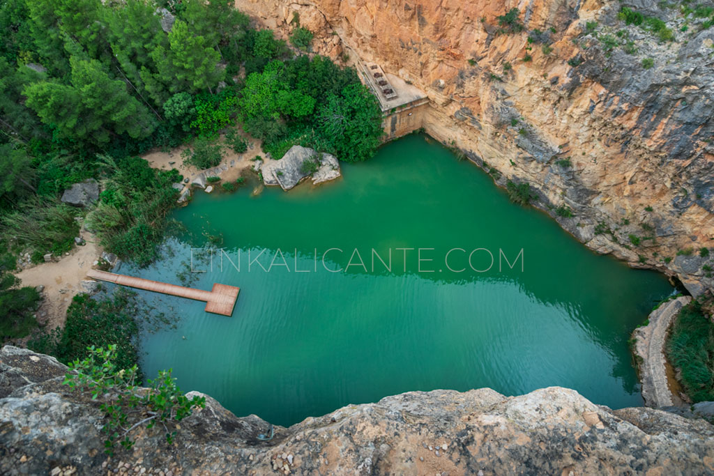
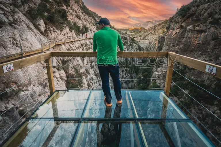
As soon as the route begins, the first surprise arrives: two viewpoints that defy the void and overlook the Turia canyon, just above the vertical of Charco Azul : the Mirador de Compuertas and the Mirador de la Carrucha . After delighting in the views of both, we continue the route in a gentle descent, walking along the edge of the spectacular gorge. In this area it is advisable to be very careful if we have small children .
The gentle descent leaves us at the Paraje de Los Calderones , which gives its name to the entire protected area. Here, the Rambla de Losa flows into the Turia next to the steepest gorge, called “La Punta”. In the past, the people of Chulilla used to come here to eat “La Mona de Pascua”, a tradition of Holy Week in Valencian lands.
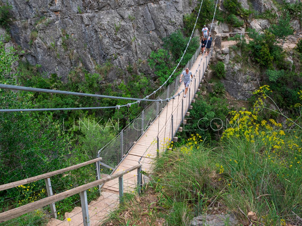
From the area of Los Calderones, a moderate climb brings us closer to the entrance to the first of the suspension bridges . First, we have to go down some steep stairs.
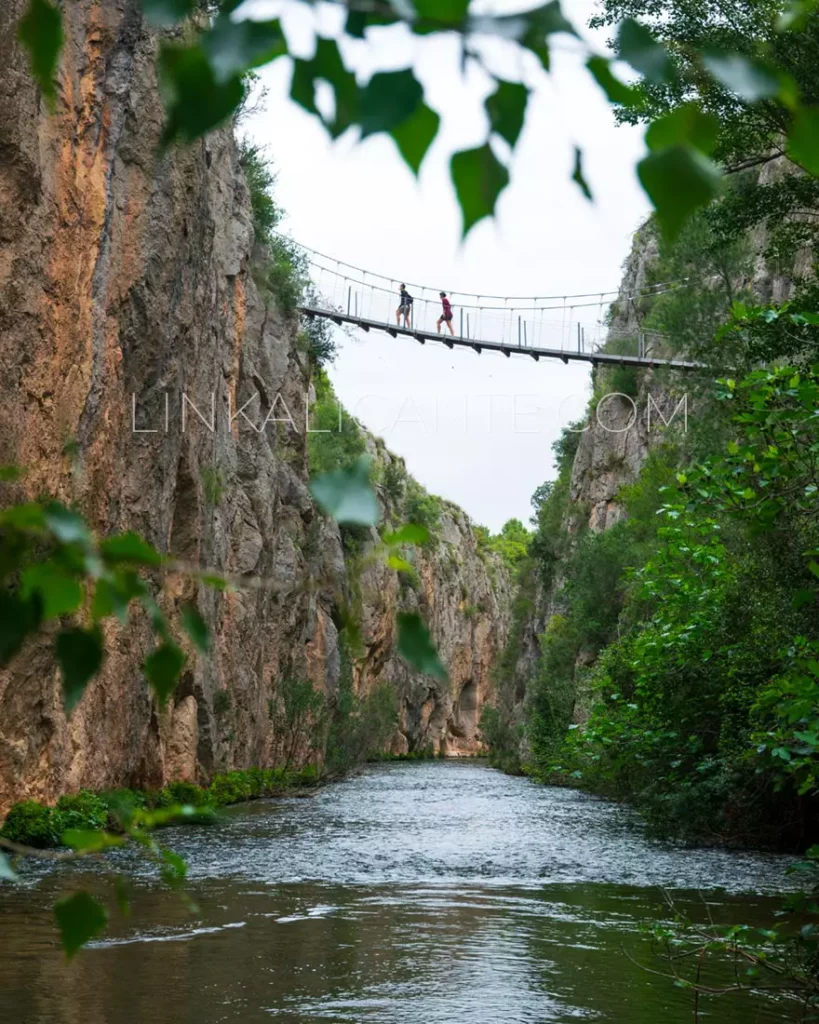
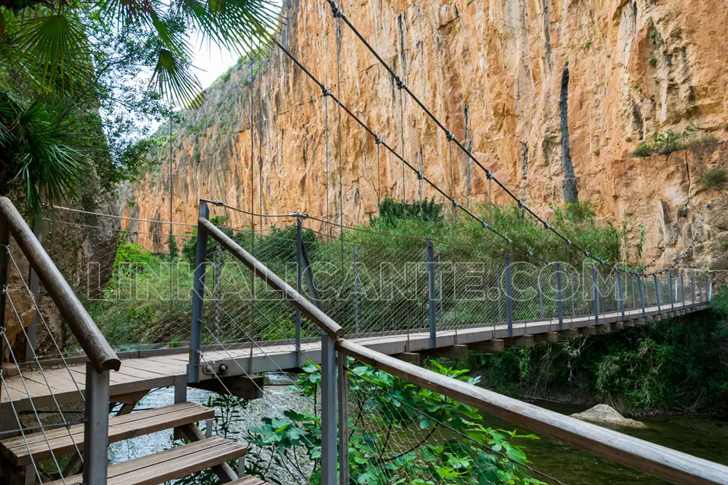
This first bridge, 21 meters long, crosses the Turia Canyon from side to side, suspended about 15 meters above the river. The construction, with steel, wood and iron, is solid (although it sways) and very well finished.
After overcoming the first suspension bridge, a new flight of stairs leaves us in a particularly beautiful area where the river occupies the entire width of the gorge, with impressive vertical walls that practically touch each other. The riparian vegetation, the murmur of the water, the calm of the place… They are factors that invite contemplation and relaxation. Something that we will only find if we avoid weekends or get up very early… It is the only “downside” of this excursion.
Just a few meters ahead we reach the second of the suspension bridges , which in this case is about 5 meters above the river, with a length of 28 meters.
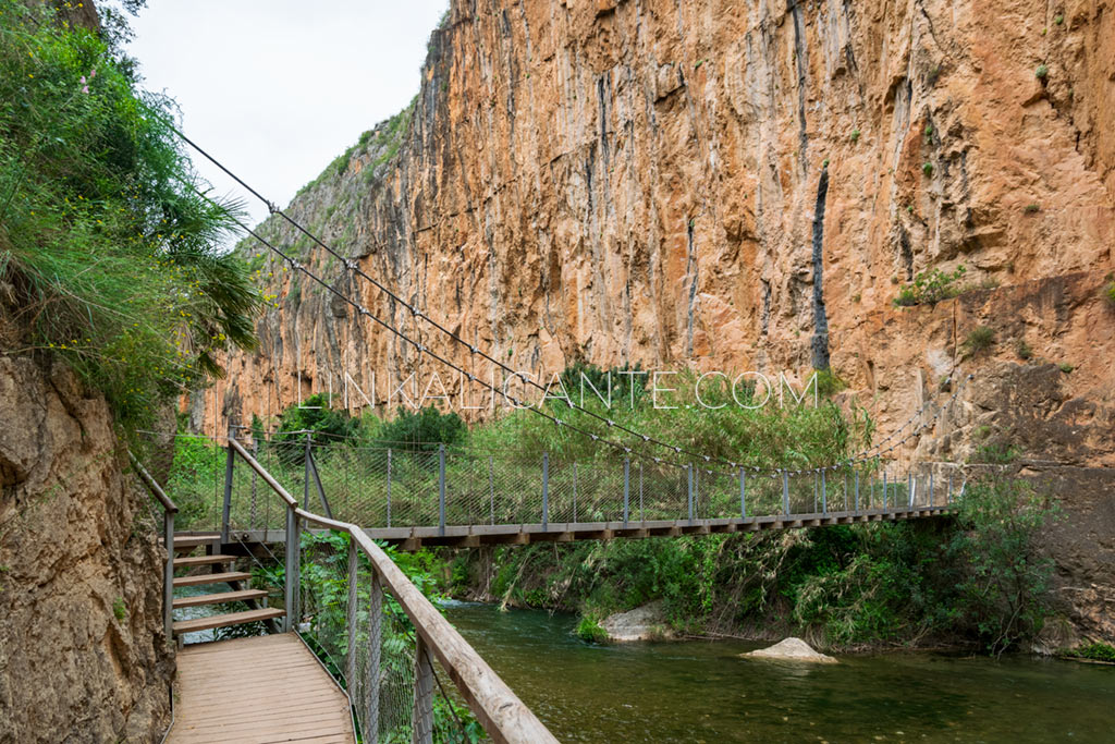
Many people end the route on this second suspension bridge, attracted only by the instagram charm of the bridges. We think that it is worth continuing the path to the Loriguilla Reservoir , thus emulating the original route followed by the long-suffering dam builders. In this way, in addition, we enter the less crowded section of the route, where the walls of the Turia canyon reach one of its most spectacular points.
I kept wondering how such vertical, plumb-cut walls could have been formed . Geology gives us the answer: millions of years ago, the Turia managed to find a way through small faults and fissures in a huge mass of limestone. Little by little, in an incessant task, the waters were undermining the hard rock that, losing its foundations, collapsed in large blocks, the origin of the vertical cuts of the canyon.
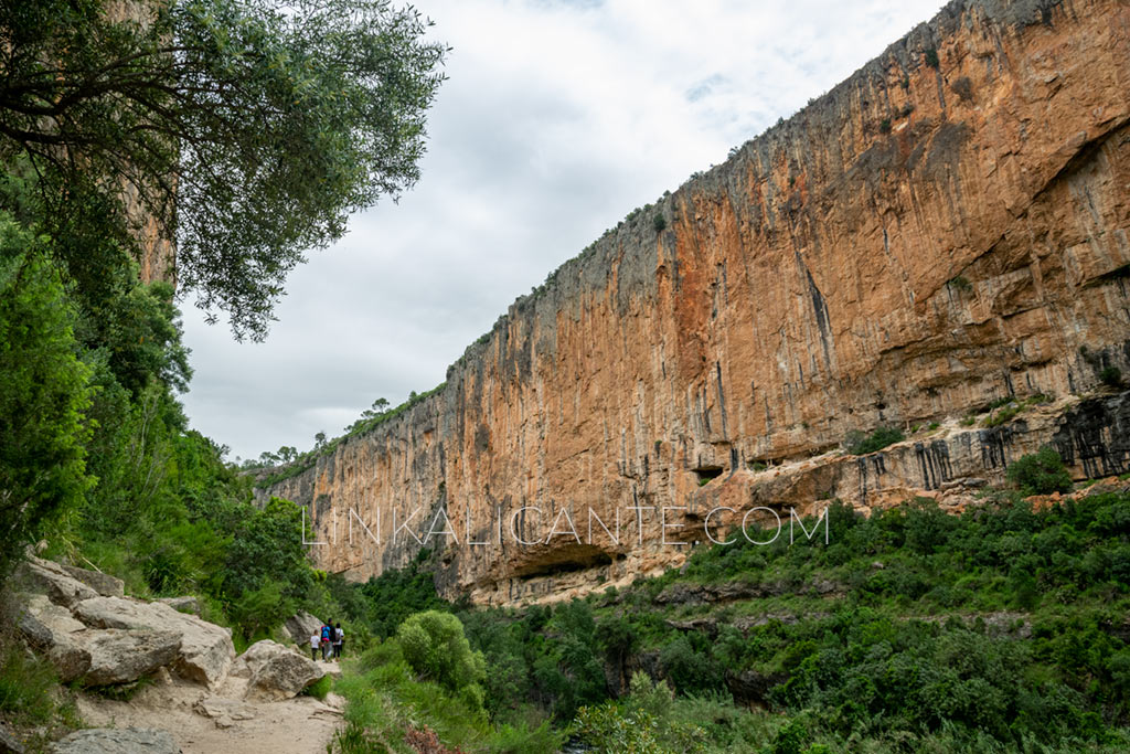
In this area it is common to find climbers , testing their limits on these vertical walls. They were probably the ones who made this spectacular route popular, making it known to the general public.
Finally, shortly before reaching the Loriguilla Reservoir, the ravine opens up and we leave the underworld of gorges to climb to the top of the dam. Considering the way to go finished, we only have to return on our steps. Something that, on this occasion, does not matter to us in the least, since it will allow us to enjoy for the second time a landscape that one would never tire of traveling…
Things to see in Chulilla
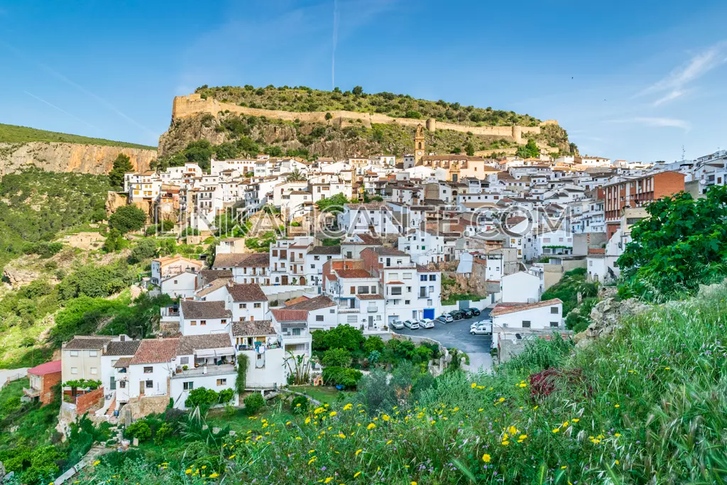
It is worth taking advantage of the visit to Chulilla to make a getaway for a couple of days to enjoy this beautiful town, its wide range of hiking trails, cave paintings, visit to its castle and other heritage and, of course, taste the delicious local cuisine. Also in the area we can enjoy other fantastic routes, such as the Peña Cortada Aqueduct in Calles.
Frequent questions
Hanging Bridges of Chulilla
The origin of this excursion, also known as Ruta de los Pantaneros, dates back to the construction of the nearby Loriguilla Reservoir: at that time, in the fifties, the workers of the dam devised and materialized this improbable route through the Sickles of the Turia; it was a shortcut that allowed them to walk from the town of Chulilla, where they settled temporarily while the construction work continued. Little did they imagine that, years later, the route would end up becoming a major tourist attraction for the Los Serranos region, in the interior of the province of Valencia.
Video: Pantaneros Route
I encourage you to watch the following video, made by the City Council of Chulilla , which perfectly describes the Ruta de los Pantaneros as well as other attractions of the population.
Start point location
Where to start the route of the Hanging Bridges of Chulilla? Although there is space to leave the vehicle next to the road, in the area where the route begins, we recommend parking further down, in this parking lot at the exit of Chulilla (Urbanización Santa Bárbara). In just 500 meters we reach the entrance to the Natural Park.
Remember that to access the route on foot, every day there is capacity control and an eco-tax (1 €) is charged for the maintenance of the site -in my opinion, justified and with a very reasonable symbolic price-.
Circular Alternative Route
If you are in good shape and want to do a circular variant of the Hanging Bridges Route, I recommend this 16-kilometre route with a drop of just over 400 metres, which passes through the cave paintings of the Barranco de Valfiguera and Charco Azul .
More Routes in Valencia
Top 15 Best Hiking Trails in Valencia and CV
Discover these 15 Routes in Valencia and Comunitat Valenciana that you can not miss: walk into the most incredible places.

Pingback: Top 15 Hiking trails in Valencia and the Valencian Community - TripTerránea